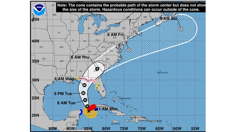
NWS: Hurricane Michael expected to strike panhandle Wednesday
Published 3:34 pm Tuesday, October 9, 2018

- NWS Image
|
Getting your Trinity Audio player ready...
|
Hurricane Michael is now in the Gulf of Mexico and will continue to move toward the north, before turning northeast toward the Florida panhandle. The storm will likely be a category 3 hurricane at the time of landfall, but will rapidly weaken as it moves inland. There is a chance that Alabama’s southeastern most counties could see a brief window of stronger winds on the northwest side of Michael. Heavy rains will also be a threat across the southeast counties as the storm moves inland.
POTENTIAL IMPACTS
* WIND:
Prepare for life-threatening wind having possible extensive impacts across Pike and Barbour Counties. Potential impacts in this area include:
• Considerable roof damage to sturdy buildings, with some having window, door, and garage door failures leading to structural damage. Mobile homes severely damaged, with some destroyed.
Damage accentuated by airborne projectiles. Locations may be uninhabitable for weeks.
• Many large trees snapped or uprooted along with fences and roadway signs blown over.
• Some roads impassable from large debris, and more within urban or heavily wooded places. Several bridges, causeways, and access routes impassable.
• Large areas with power and communications outages.
Also, prepare for dangerous wind having possible limited to significant impacts across areas southeast of Interstate 85.
* FLOODING RAIN:
Prepare for locally hazardous rainfall flooding having possible limited impacts across Pike, Bullock, Barbour and Russell Counties.


